%20(1).png)
Gosainkunda & Helambu Trek - 2023 Trip Report
- petermorley200
- Mar 4, 2024
- 11 min read
Updated: Nov 4, 2024

Contents
Introduction
I spent a week doing the Langtang trek (click here to see my blogs). I then continued on to the Gosainkunda and Helambu treks which took that another week. I like longer treks and it made sense to do all 3 of these short treks while I was in the area.
I had considered adding on the 5 day Tamang Heritage trail as this links up with the Langtang trek. However, it didn’t appeal to me as it is a low altitude trek and I prefer the alpine scenery at high altitude. I met 2 Canadians who had done this trek and there were huge spiders in a couple of their tea houses. I was glad I didn’t do that trek!
I was trekking with Niru who was a 31 year old porter/guide arranged through Enjoy Nepal Treks. He was a good guide and it was enjoyable trekking with him.
For information on planning the Gosainkunda and Helambu trek see my blog Planning the Gosainkunda & Helambu Trek.
28 November 2023 - Pairo to Chyolangpati
Niru and I set off from Pairo on the Langtang trek at 07.45 and soon reached the junction of the trails for the Langtang and Gosainkunda treks. We turned southwards onto the trail for the Gosainkunda trek and the trail immediately ascended steeply.
After 1.25 hours we reached a suspension bridge and met the first and only other trekker on this quiet trail to Thulo Syabru. It was so different to the busy Langtang trek. This other trekker was a 70 year old Swiss woman who didn’t speak any English and her 50 year old guide. After the end of the trek I sadly learned that the guide was found dead in his room at a tea house at Gosainkunda Lake.
After the suspension bridge there was a trail that ascended. Unfortunately that isn’t the trail to Gosainkunda which descends before climbing up to the village of Thulo Syabru. We later met some Nepali trekkers who had taken the upper trail at the suspension bridge and they wasted several hours hiking the wrong way.
From Pairo it took us 2 hours to reach the very pleasant village of Thulo Syabru (2,210 metres). Most of the village is modern and there are several good hotels. This was the nicest village since the start of the Langtang trek.
It was only 09.45 when we arrived at Thulo Syabru and so unfortunately it was too early to spend the night there. We therefore ordered an early lunch of dal bhat at the Hotel Mona Lisa. We spent 1.75 hours having lunch and relaxing before continuing the relentless ascent.
Most itineraries for the Langtang and Gosainkunda treks take the trail from Thulo Syabru to Shin Gompa (Chandanbari) and then onto Gosainkunda the following day. I don’t understand why as there is a more direct route via Mukharka.
We took the more direct trail via Mukharka and reached our destination of Chyolangpati (3,620 metres) at 16.30 after 7 hours of walking. I descended 1,750 metres yesterday and ascended 1,800 metres today!
There is a new tea house at Chyolangpati which is a vast improvement on the other old lodge. Initially there were only 2 other guests but at 19.00 six Nepali arrived in the dark.
I had only seen 3 other trekkers on the hike the entire day. It was therefore a surprise to see many Nepali pilgrims passing Chyolangpati on the way back down to Shin Gompa. I learned that most pilgrims don’t stay at Gosainkunda lake due to the high altitude and visit Gosainkunda lake as a day trip from Shin Gompa.
There were a lot of high clouds during today’s hike and it spoiled the mountain views. However, the weather cleared in the evening and there was a fantastic sunset over the mountains.


29 November 2023 - Chyolangpati to Gosainkunda Lake
It was a quiet night and the temperature fell to 2 centigrade in the room. I feel the cold the most in the mornings and there was no fire in the dining room for breakfast as usual.
The path from Chyolangpati (3,620 metres) to Gosainkunda Lake (4,420 metres) was fairly busy with pilgrims going up to the Gosainkunda holy lakes for the day. The path had been concreted in places and safety railings had been installed where there were drop offs.
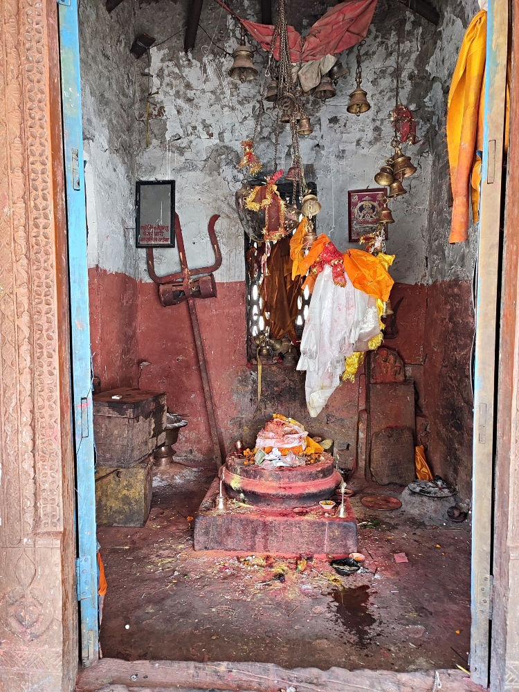
It was sunny but unfortunately high clouds blocked the views of the mountains again. It took 52 minutes to reach Laurebina which has 2 tea houses. There were good views despite the high clouds. We reached a view point near Ganesh Mandir (4,365 metres) after another hour.
It then only took another hour on an undulating trail to reach Gosainkunda lake. There are four old and basic tea houses at Gosainkunda lake. Unfortunately they are very similar to the old and dilapidated tea houses on the first section of the Langtang trek!
The Tibet Hotel seemed to be the best out of a bad bunch and I reluctantly took a room there. There were no other guests when I checked in. Shortly afterwards 3 Nepali and 2 Chinese flew into Gosainkunda by helicopter and checked into the tea house. They were a strange group and I contemplated moving to another tea house. Later on I wished I had!
In the afternoon I slowly walked around the main Gosainkunda lake and enjoyed the views. It was sunny but there was a cold wind. Whenever there was some shelter from the wind it was warm enough to comfortably sit out.
The group of 3 Nepali and 2 Chinese guests were weird. The Chinese man believed in aliens and drew strange images on paper. They were at Gosainkunda for religious reasons and at one point they started chanting and swaying. Two of the Nepali were a mother and daughter.
They were unconcerned about altitude sickness even though they were unacclimatised and had flown to Gosainkunda Lake, which is at an altitude of 4,420 metres. They were obviously wealthy as the return helicopter flight cost $4,000!


30 November 2023 - Surya Peak
The Chinese in the room next to me were noisy last night. When they started talking at 01.30 I shouted at them to be quiet and they were. Niru wasn't so lucky and couldn’t sleep well because the young Nepalese woman in the room next to him had altitude sickness and her mother was administering oxygen.
The group had intended to spend 2 nights at Gosainkunda Lake but they left by helicopter at 07.00 the next day because of the altitude and primitive conditions.
I had a spare day as we had hiked faster than I had intended after leaving Kyanjin Gompa on the Langtang trek. One option was to return to Kathmandu a day early and the other option was to hike up Surya Peak (5,150 metres). Not many people hike up Surya Peak as it is difficult to locate and the terrain is very rocky.
Niru was keen to go up Surya Peak as he hadn't been up before. He found out details of the route from the owner of the tea house. The owner estimated that it would take us 4 hours to ascend and 3 hours to descend.
We set off for Surya Peak at 07.00 with a packed lunch of Tibetan bread and boiled eggs. My Garmin Inreach said that it would be sunny all day but it was cloudy and cold.
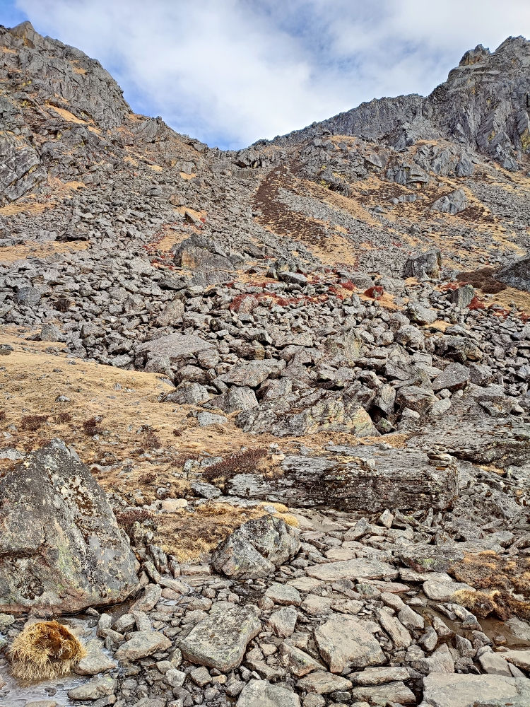
Niru found the turn off to Surya Peak and I was surprised to see cairns marking the way. The terrain was extremely rough. We walked across stones and boulders the entire way and had to ensure they were stable before treading on them.
There was some scrambling and in a couple of places a slip could have been fatal. I find it easier to ascend than descend on tricky sections and I was concerned about the safety of the descent.
It took 3 hours to reach the summit of Surya Peak and I was very happy to have made it. The trail had been well cairned the entire way. There were a lot of prayer flags at the summit but I was surprised that my Garmin Inreach showed the altitude to be only 5,049 metres. Surya Peak is meant to be at an altitude of 5,150 metres.
I later learnt that we had climbed to the wrong peak. Someone on the internet called it "Gosainkunda Ri". See my blog on Planning the Gosainkunda Trek for further details.
It was cloudy and cold but we could see a few peaks. We probably only spent 20 minutes at the top because of the cold wind. I was relieved when Niru said there was a safer, but longer, way back to Gosainkunda lake. We had hiked up the south side of Surya Peak and the safer descent was initially down the north side.
After the initial steep and rocky descent from Surya Peak we ate our packed lunches. We didn’t stop for long as it started to snow lightly. Niru was concerned about the deteriorating visibility as he was relying on being able to see the mountains for navigation.
The route back to Gosainkunda lake was far less hairy than the route up although it still involved constant boulder hopping and the terrain was very rough. Every so often we would come across an isolated cairn and it provided reassurance that we were on the correct route.
We reached Gosainkunda lake at 13.30 and the circular hike took us 6.5 hours. I immediately ordered lunch and found that there were several other Nepali trekkers in the dining room. In the afternoon it started to snow and up to an inch of snow settled on the ground.
I relaxed in the warm dining room for the rest of the day. In the evening a young Nepali couple arrived in the dark. They live in the U.S.A. and were very friendly. The tea house was now full, which I never like. Fortunately it wasn’t noisy during the night and I slept well.


1 December 2023 - Gosainkunda Lake to Ghopte
We left Gosainkunda lake at 08.00 and ascended 130 metres to the Suryakund/Laurebina pass. There was some snow on the trail but fortunately the weather had improved today and it was sunny.
After the pass we descended steeply for over 2 hours until we reached a tea house at Phedi (3,630 metres). There were 2 newsworthy events here in the early 1990's:
In July 1992 a Thai Airways jet crashed just below Phedi and 113 people died. A trainee air traffic controller was at fault. There were parts from the plane at the tea house.
A young Australian doctor (James Scott) got lost here in December 1991 and survived for 43 days without food. He was eventually found through the great efforts of his sister. Unfortunately he suffered permanent damage to his eyesight from vitamin deficiency. I had read his book about this and was interested to see where it had happened.
James Scott got lost in snow as when he turned back he wrongly thought he had to descend at Phedi. In reality the path from Phedi to Ghopte ascends steeply before descending. Unfortunately we had to do this ascent after having dal baht!
We reached the settlement of Ghopte (3,430 metres) after about 7 hours of walking from Gosainkunda lake, including a stop for lunch. There are 2 basic, but reasonable, tea houses at Ghopte. We were the only people staying at the Namaste Hotel & Lodge. It was quieter and warmer than at Gosainkunda lake.
There were 2 other trekkers from the Czech Republic and Australia staying at the other tea house. The trail from Gosainkunda lake to Helambu is so quiet compared to the busy Langtang trek and the trail from Chyolangpati to Gosainkunda lake.


2 December 2023 - Ghopte to Kutumsang
The day started with a 300 metre ascent to Thadepati Pass (3,730 metres) and it took 1 hour 40 minutes. There are good mountain views from a metal lookout tower at Thedepati . There are 3 or 4 tea houses at Thedepati and we stopped for tea.
After Thedepati we left the trail for the Gosainkunda trek and started a section of the Helambu trek. We were going to hike south on the trail for the Helambu trek until we reached Sundarjal. We could have hiked east on the Helambu trek instead but it would have been more difficult to travel back to Kathmandu from that end of the trail.
We hiked for another 1.5 hours to Magengoth (3,390 metres) and had lunch there. Three British trekkers arrived from the other direction. They were very poorly prepared for their Gosainkunda trek and didn’t even have enough cash. They were trying to use a debit card at the tea house and I was surprised that they might be possible.
After another 2.25 hours we reached our destination of Kutumsang (2,470 metres). We found a new hotel which had good rooms and my guide negotiated a rate of R800 ($6). It was the best accommodation for some time. I even had a hot shower.
The only problem was that the room had a funny smell, even with the windows open. Another trekker told me that it was probably because there wasn’t a U bend in the shower drain pipe to prevent smells coming from the sewer pipe. It seems to be a common problem with cheap hotels in Nepal.
There seemed to be only 3 other trekkers staying in Kutumsang. There was a Czech trekker staying at my hotel and a French trekker and an Australian trekker staying at other hotels.
The French trekker was in a rush to get back to Kathmandu and didn’t have time to finish the Helambu trek. He was taking a local bus from Kutumsang to Kathmandu early the next morning. The bus stops at most of the local villages and takes about 8 hours.


3 December 2023 - Kutumsang to Chisapani
The trail had been beautifully quiet ever since we left Gosainkunda lake on 1 December and there were only 2 other trekkers descending on the Helambu trail. The pilgrims that go to Gosainkunda lake fortunately go back down the same way rather than continuing on to Helambu.
The scenery was not as spectacular as higher up. However, when looking back there were often views of the Ganesh Himal, Langtang and Everest mountain ranges. Manaslu could be seen and it's the world's 5th highest mountain.
After leaving Kutumsang we followed rough dirt roads for a while which I am not keen on. Fortunately the traffic on the dirt road was very minimal. Although we were descending towards Kathmandu there was also a lot of ascent!
It took 3 hours to reach Chipling. There are 2 or 3 tea houses there and I had vegetable fried noodles for lunch. After Chipling there was a steep 500 metre descent followed by a steep 400 metre ascent to Chisapani. That took 3 hours.
I stayed at a good hotel again and took their best room for R1,500 ($12). The other rooms cost R1,000. There were only 2 other trekkers staying there. There was a youngish trekker from the Czech Republic, who I was now friendly with, and a very quiet South Korean woman. Both were trekking by themselves.
The hotel was temporarily being run by a 17 year old girl as her parents are in Kathmandu. She could only cook dal baht for supper. Luckily I hadn’t had dal baht for lunch. For breakfast she could only cook Tibetan bread and omelette and I liked that.
In the evening I had a beer with Niru to thank him for the trek and I gave him his tip. I had enjoyed his company and he had been an excellent guide.
The room was quiet and very nice except for the noise from stray dogs. A pack of them fought outside my room at 23.00 and 05.30.


4 December 2023 - Chisapani to Kathmandu
Niru and I walked through Chisapani, passing an abandoned building that had been drastically tilted by the 2015 earthquake. After Chisapani the Helambu trek enters the Shivapuri Nagarjun National Park. I had to buy an entrance permit for R1,000 ($8) and I paid R100 for Niru’s entrance permit.
The trail for the Helambu trek steeply ascends 300 metres from Chisapani and afterwards descends 1,000 metres to the town of Sundarjal. The trail goes through forest and there are very few views. It took less than 4 hours to reach Sundarjal. We stopped for lunch and then took a taxi to Thamel that cost about R1,000 ($8).

5 & 6 December 2023 - Kathmandu
My flight back to the U.K. was at 02.30 on 6 December. I had one full day in Kathmandu and occupied my time with a visit to Bhaktapur. I had been there last year but I always enjoy walking around its quiet streets.
The Qatar Airways flight went well and I arrived back in the U.K. on the afternoon of 6 December. I had spent 42 days in Nepal and had trekked for 33 days in Kanchenjunga, Langtang, Gosainkunda and Helambu. It was a very enjoyable trip.
Amazing article and photographs, thank you.
https://www.nepalnomad.com/gosaikunda-trek